Two Patagonian National Parks in Two Countries: Parque Nacional Los Glaciares and Parque Nacional Torres del Paine.
From the southern island of Tierra del Fuego with the national park of the same name, I flew north to El Calafate and caught a three-hour bus ride to El Chatlén, which is marketed as the trekking capital of Argentina. This is a new moniker as up to about ten years ago the town was a one street passway to the northern reaches of Parque Nacional Los Glaciares and Mt. Fitz Roy climb. Someone with a marketing background must have realized the potential and the town started to grow. Since Covid, there has been a real boom in tourism with primarily European, Chinese and Japanese hikers, climbers and gawkers. The prices have also skyrocketed. I was told that food and accommodation are twice as expensive this year compared to last, but the salaries for the people working in the area have not increased. I found both El Chatlén and El Calafate to be much more expensive than it is in most European countries, and this came as a shock as I had anticipated Argentina to be less costly.
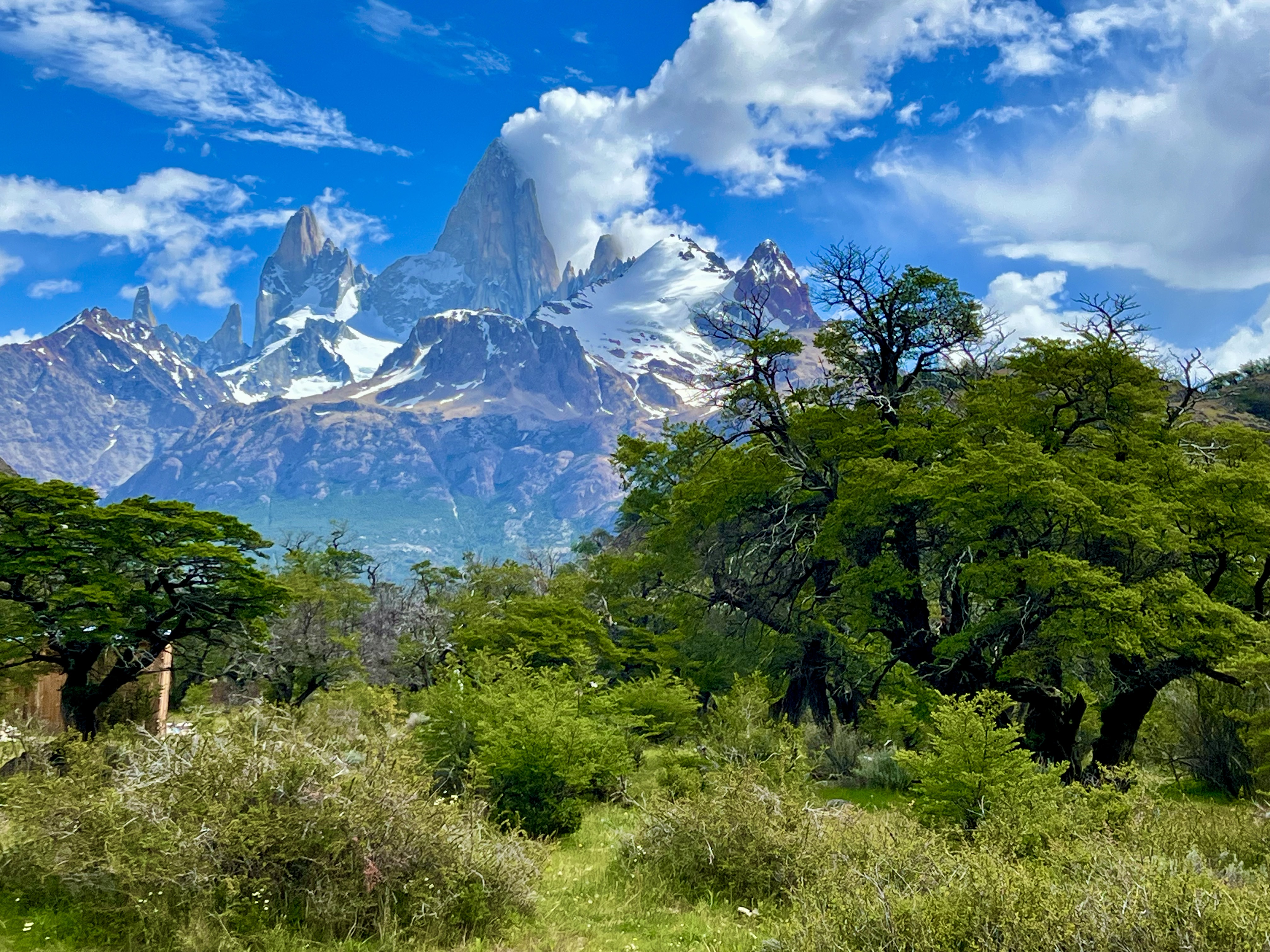
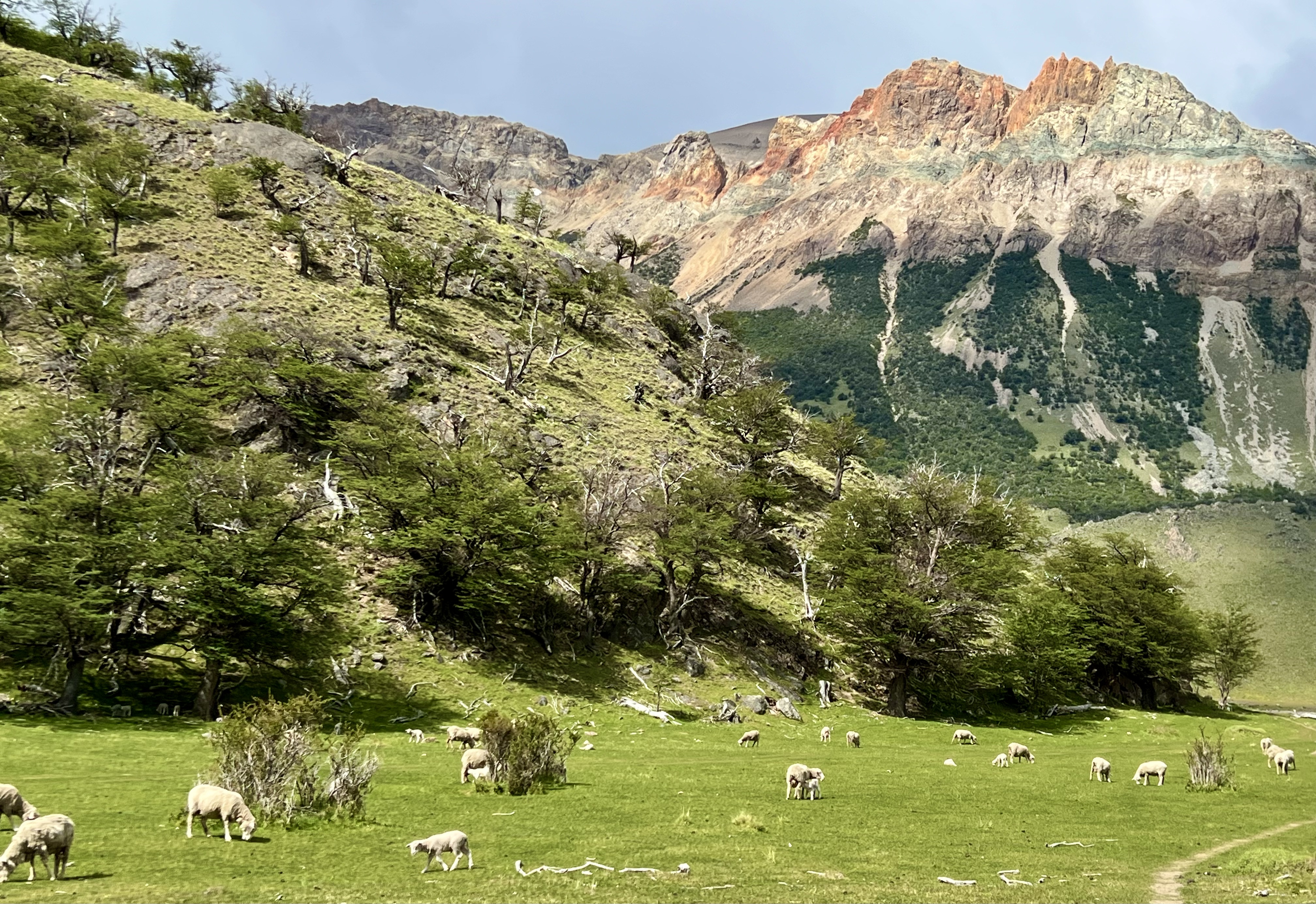
El Chatlén sits on the Rio de las Vueltas with Parque Nacional Los Glaciares behind it. Across the river and to the north are large estancias, working ranches. The setting is stunning especially when the sun comes out and the clouds clear from the mountains. The main street is only about 1.2km long with the park information center in the south by the entrance to the two mirador (lookout) trails and a check booth to the north at the entrance to the Fitz Roy and Lagunas treks. The entrance fee here was the same as in Tierra del Fuego, US $45 for one day, US$90 for a flexible three-day pass. I was still feeling sick from the chill in Ushuaia and wasn’t up for an eight-hour + hike to the Fitz Roy viewpoint, so I opted for an all-day trail ride at the Bonanza Estancia just outside of town. This was a fascinating experience, and one I can highly recommend. The name was taken from the US television series Bonanza, but instead of cattle I saw lots of sheep and horses. The estancia is huge, we rode for over two hours in a more or less straight direction to Laguna Liti and had not reached the end of the property – and this was in only one direction! Apparently, in the 1880s the government was having issues with Chile regarding the border, which I understand are still somewhat ongoing, so they offered large tracts of land to anyone who was willing to work it, either through animal husbandry or agriculture. Agriculture is difficult in this region, but it is perfect for sheep. Merino sheep are not just in New Zealand, they are in Patagonia as well. The original settlers came in 1883 to lay claim to what is now the Bonanza ranch. The ranch hands come from all over. They seem to be mostly in their twenties, maybe early thirties, with a few regulars who are more mature. They have seasonal jobs as in the winter everything for the tourists locks down, but in the fall, spring and summer, the horses need to be rounded up from their free grazing pampa
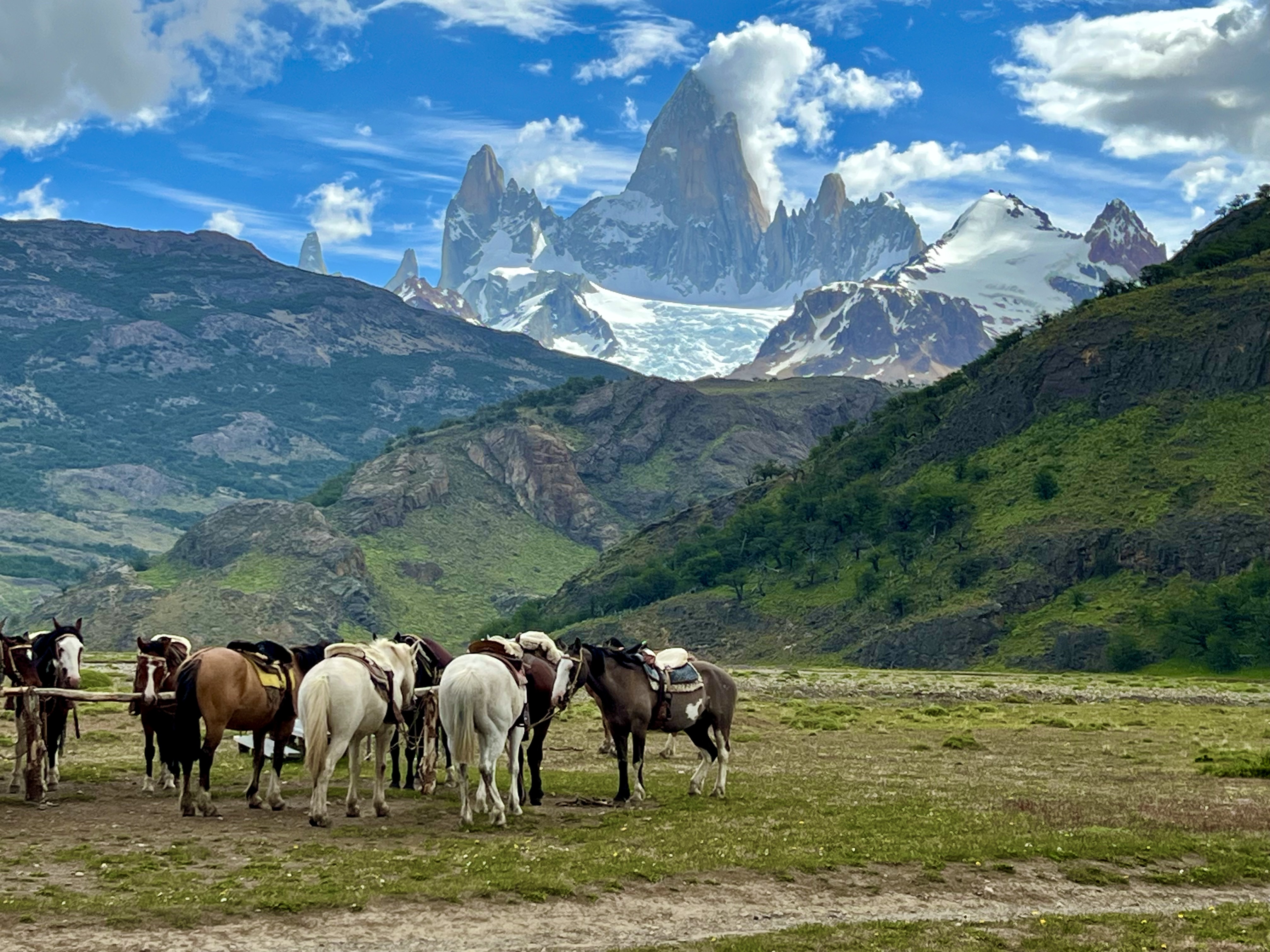
(the ranch doesn’t have any stalls), groomed, tacked up, and made ready for the tourists’ trail rides. At the end of the day, the horses are again groomed and then set free to run across the flat pampa grasses at will. They are well taken care of. The ranch hands receive some compensation, but also room and board, which makes it a perfect seasonal job for someone who loves the outdoors. The trail guide on my tour was a young woman from the Spanish Pyrenees who works in her parents’ souvenir shop in the European summers and is now spending the European winter in Patagonia’s summer. On the ride with me was a young man from London who had just completed a modified mountain triathlon with hiking instead of swimming, three Czech young men who had just completed the longer Fitz Roy trek and a young couple from Columbia who were simply enjoying each other and the region. The trail took us first through a canyon where we could see the white condor droppings indicating where they had a nest, and then up into the hills. After about two hours, we came to a pond/small lake, named from the first two letters of the original owners first names, Laguna Liti. While one of the gauchos prepared a hot meal of chicken stew, we took a short hike up to a viewpoint where we could see all the way to Lago Desierto and Desierto glacier in the north, with many of the glaciers around Fitz Roy on the other side of the valley. We were lucky with the weather; it was cool, but sunny. The clouds played on the mountain tops, sometimes completely obscuring them, and at others allowing a peak or two at a summit. The almost ubiquitous Calafate bush covered the hillsides and had not quite ripe red berries; I ate one anyway wondering if the legend would allow me to return. The ride back was the same way we came, but the views were naturally different. After the trail ride, there was a local treat of fried bread that reminded me of Navajo fried bread, and coffee before the van ride back into town.


The following day, still not quite well, I planned on doing the two shorter overlook trails and walked to the other side of town and the Visitor’s Center. There I was told that I needed to pay the US $45 to go on those short hikes. This didn’t seem worth it for what would have been at most two hours on a trail, so I walked back to the north side to search out a path that didn’t cost anything. The regular entrance to the Sendero al Salto is through the park entrance, but it follows the road which is free. I found a small path through the fields between the two that was lovely. It didn’t go very far before I came to an overlook over the almost bare river looking back towards the estancia. It was a very peaceful setting. In the summer, i.e., in January and February, the melting glaciers fill the river making it torrent down the valley, but at the end of November, it was still fairly shallow.


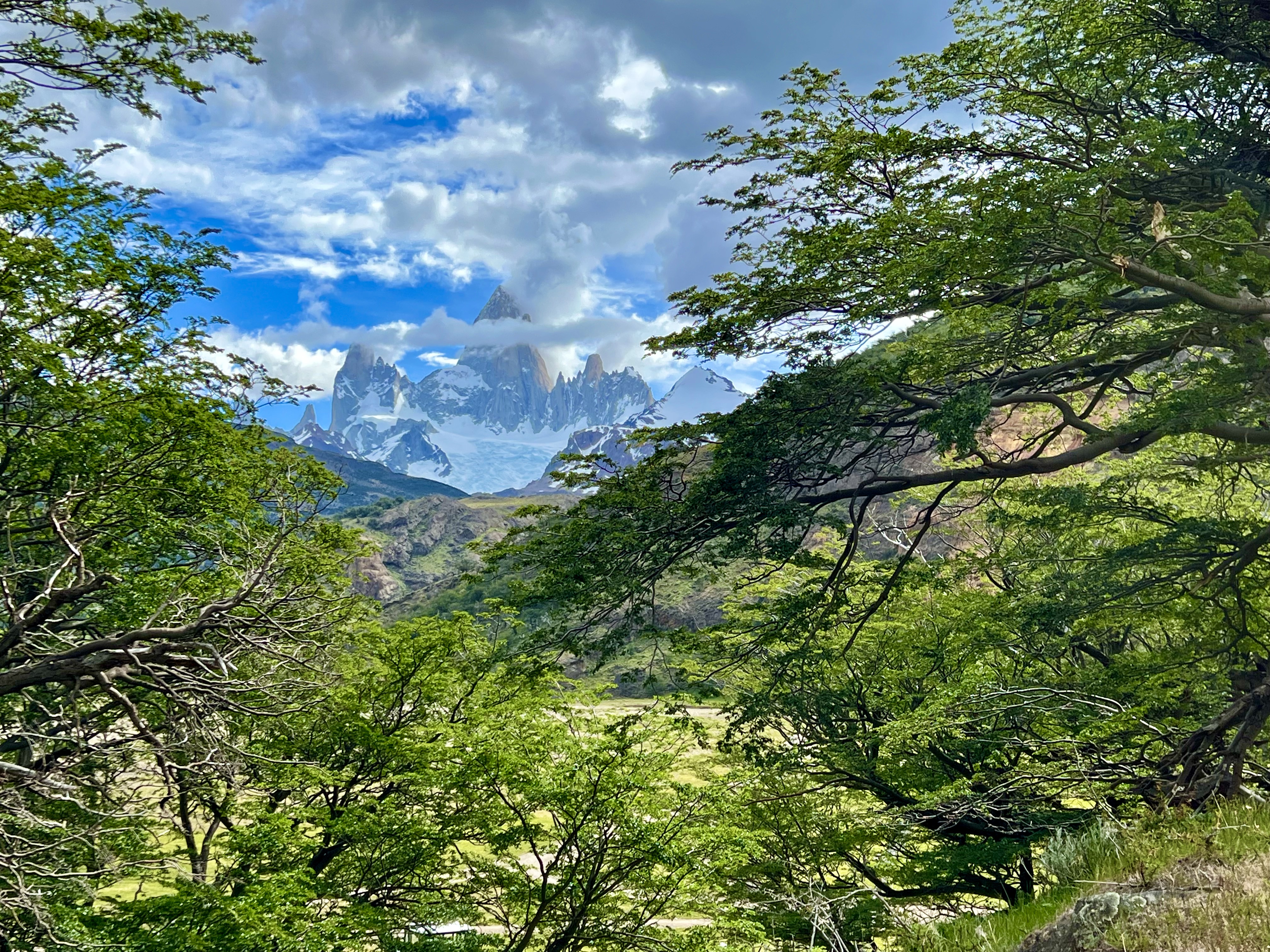
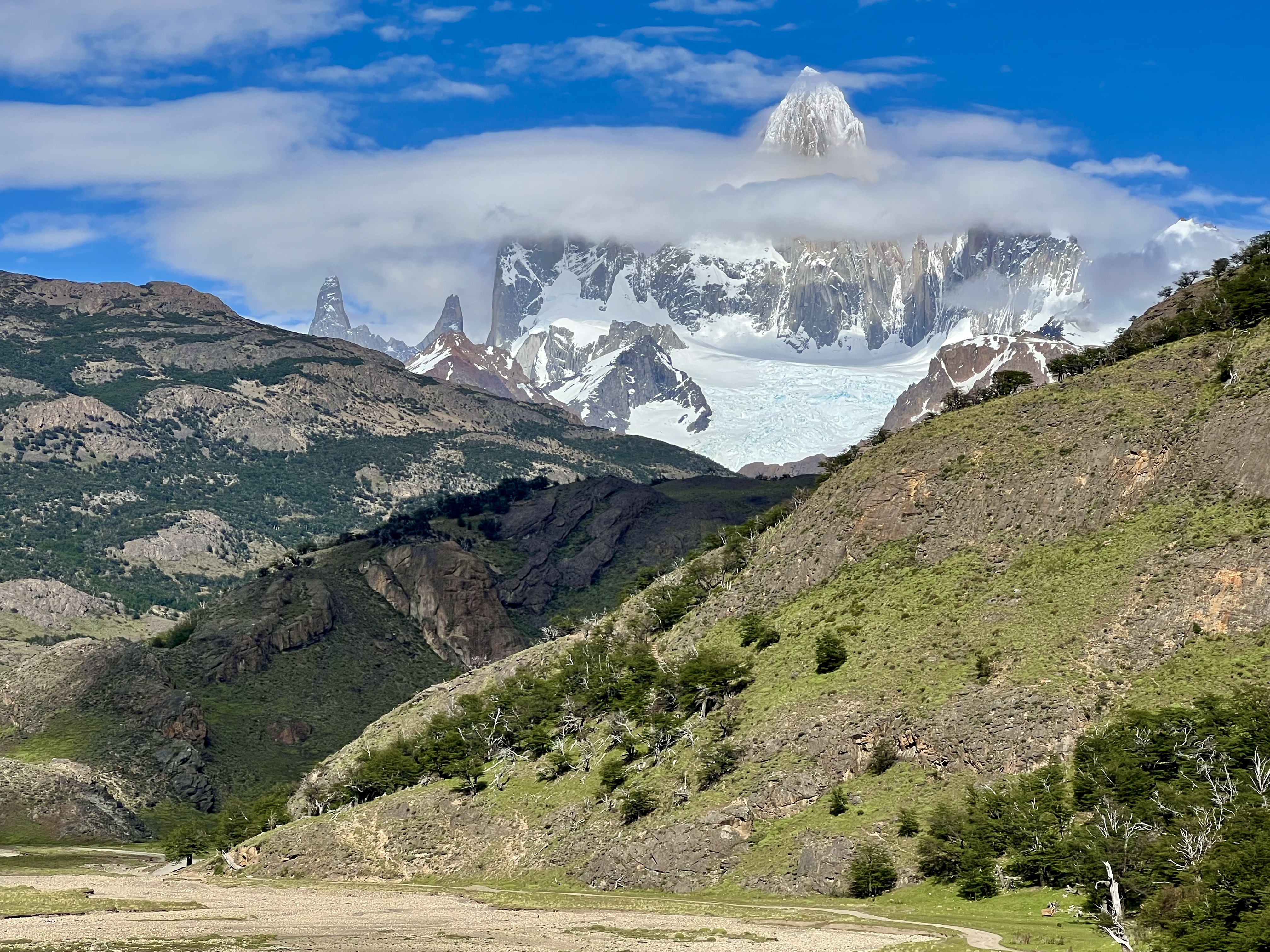
I only had about a day and a half in El Chatlén and didn’t do any of the trails I had planned on, but it turned out to be perfect the way it was. Especially as judging from all of the people I saw heading for the few major trails, I’m guessing they would have been busy and not nearly as peaceful as the experiences I had. Mt. Fitz Roy lords over the town but is rarely completely visible as the clouds seem to love his peak. The mountain was named after Robert Fitz Roy, who led the second Beagle expedition for the British, with young Charles Darwin as crew, and investigated some of interior in 1832. The Beagle Canal is named after the ship that was the first to cross the waterway from the Pacific to the Atlantic. My trip was shorter, from El Chatlén I took the bus back to El Calafate, where I was staying for the next three nights. The van follows Ruta 40, which runs along the Andes throughout Argentina. We stopped for a coffee at an inn and I was surprised to see posters of the Sundance Kid and Butch Cassidy here. I’d known they had made to Bolivia, but hadn’t realized that they rode all the way to Patagonia, with the wanted posters following them. The landscape around the inn and along this stretch of Ruta 40 is very similar to the North American West.

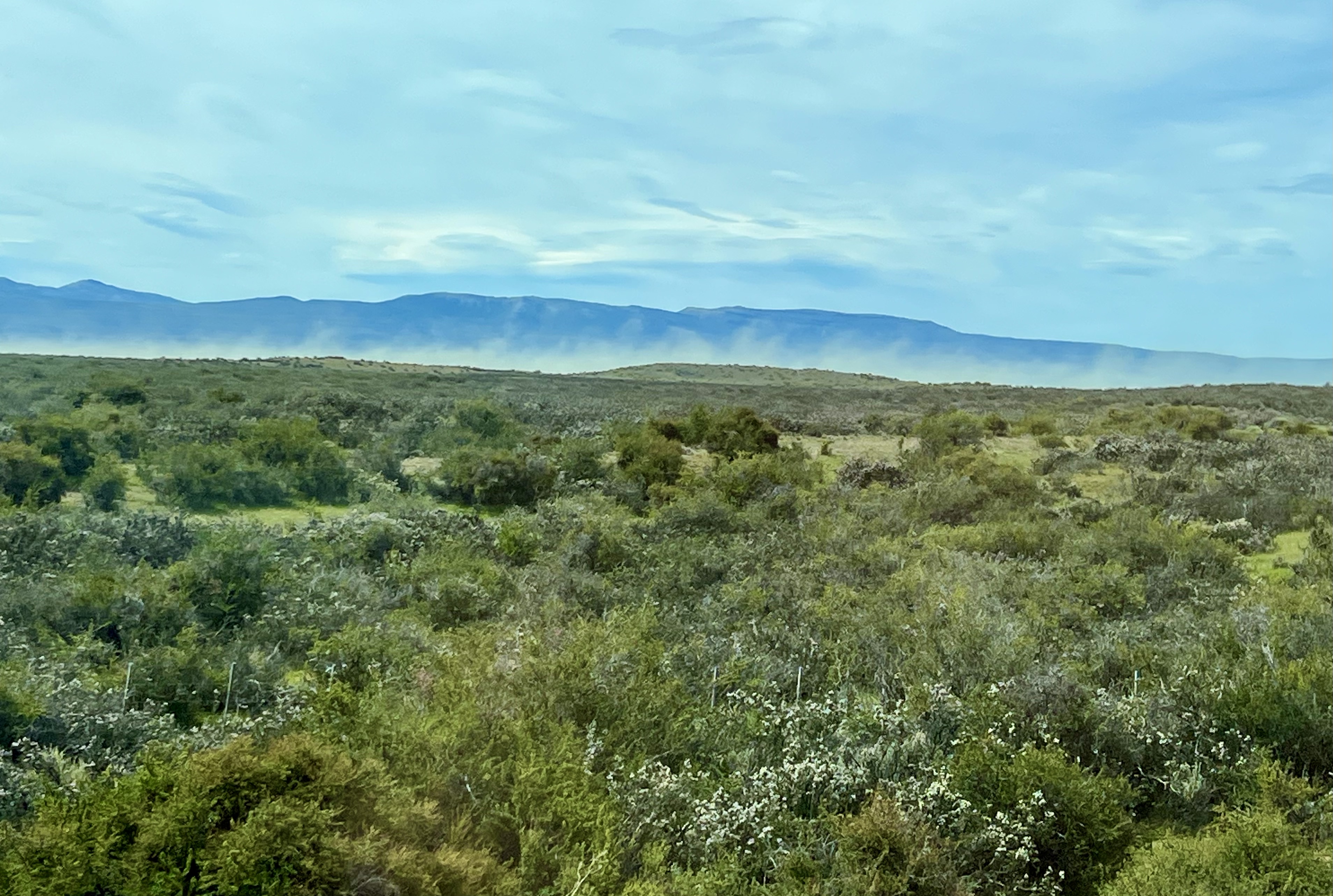

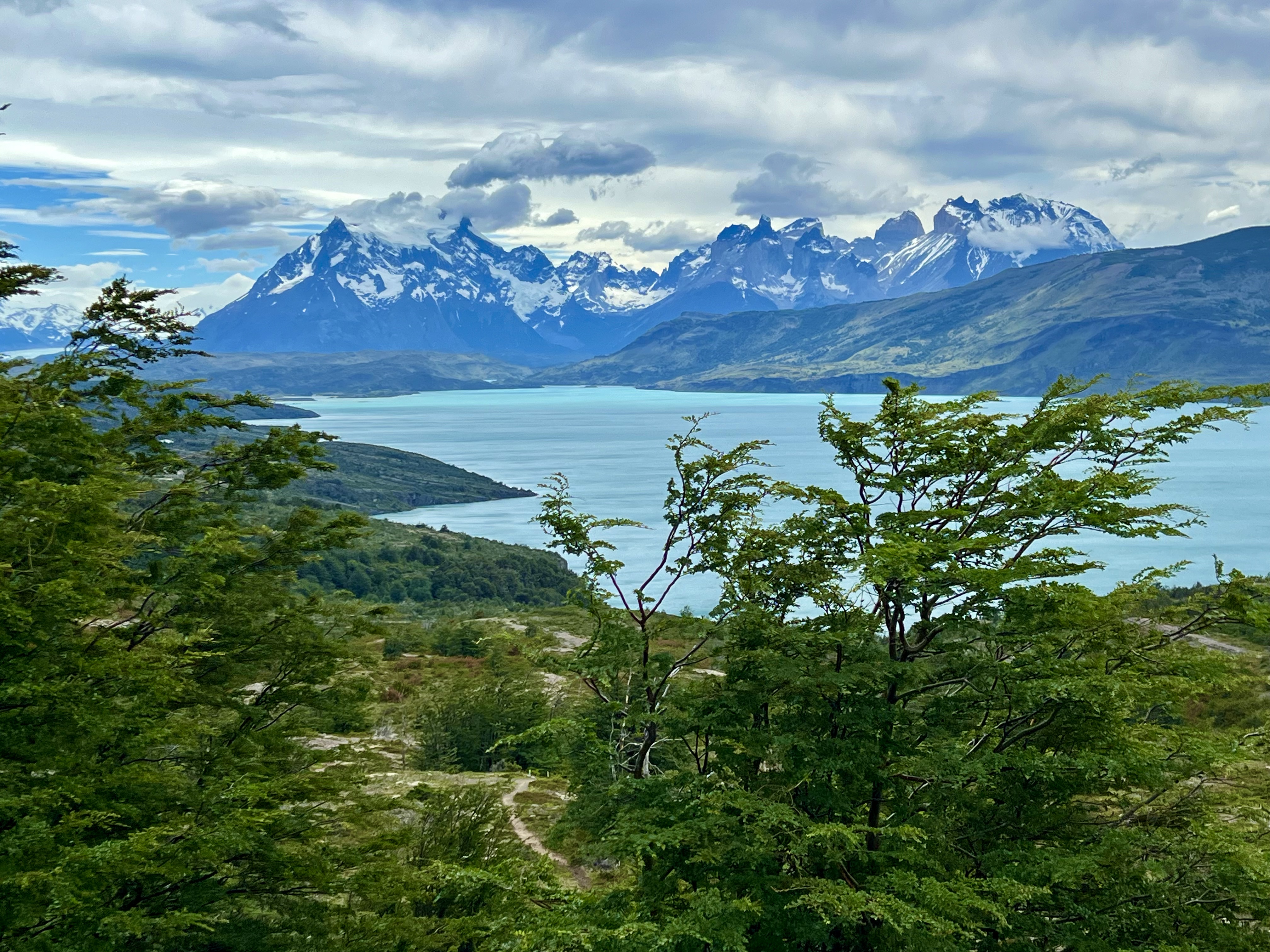
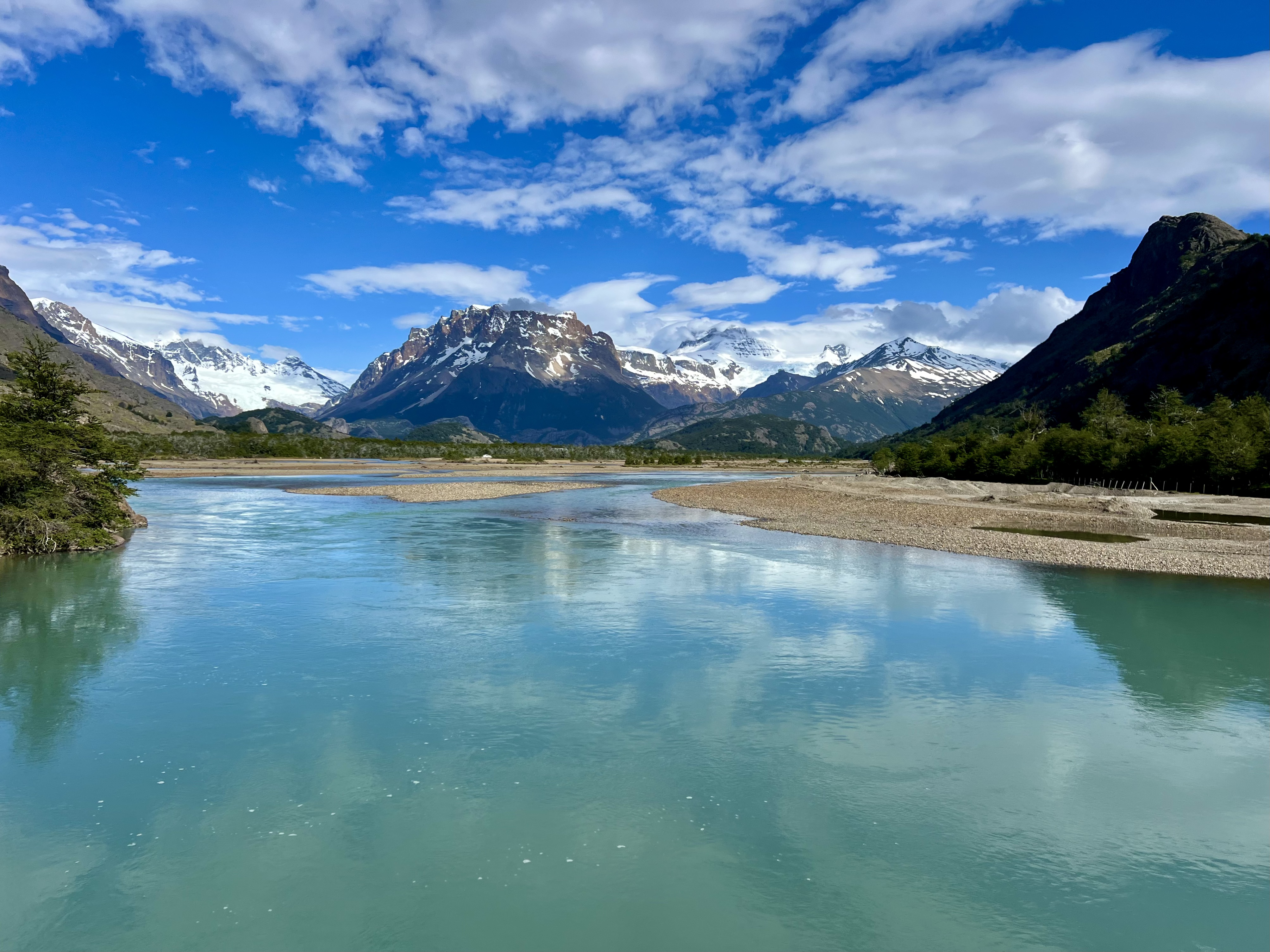
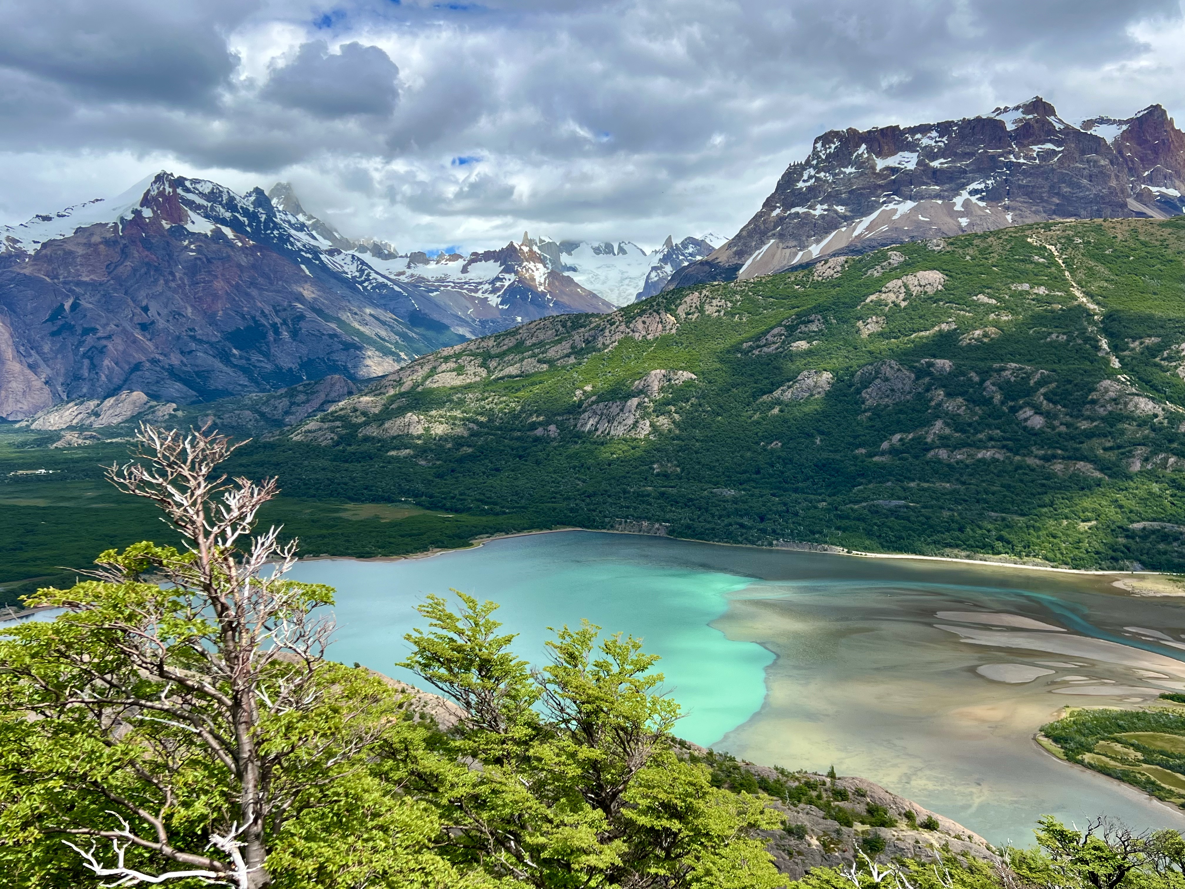
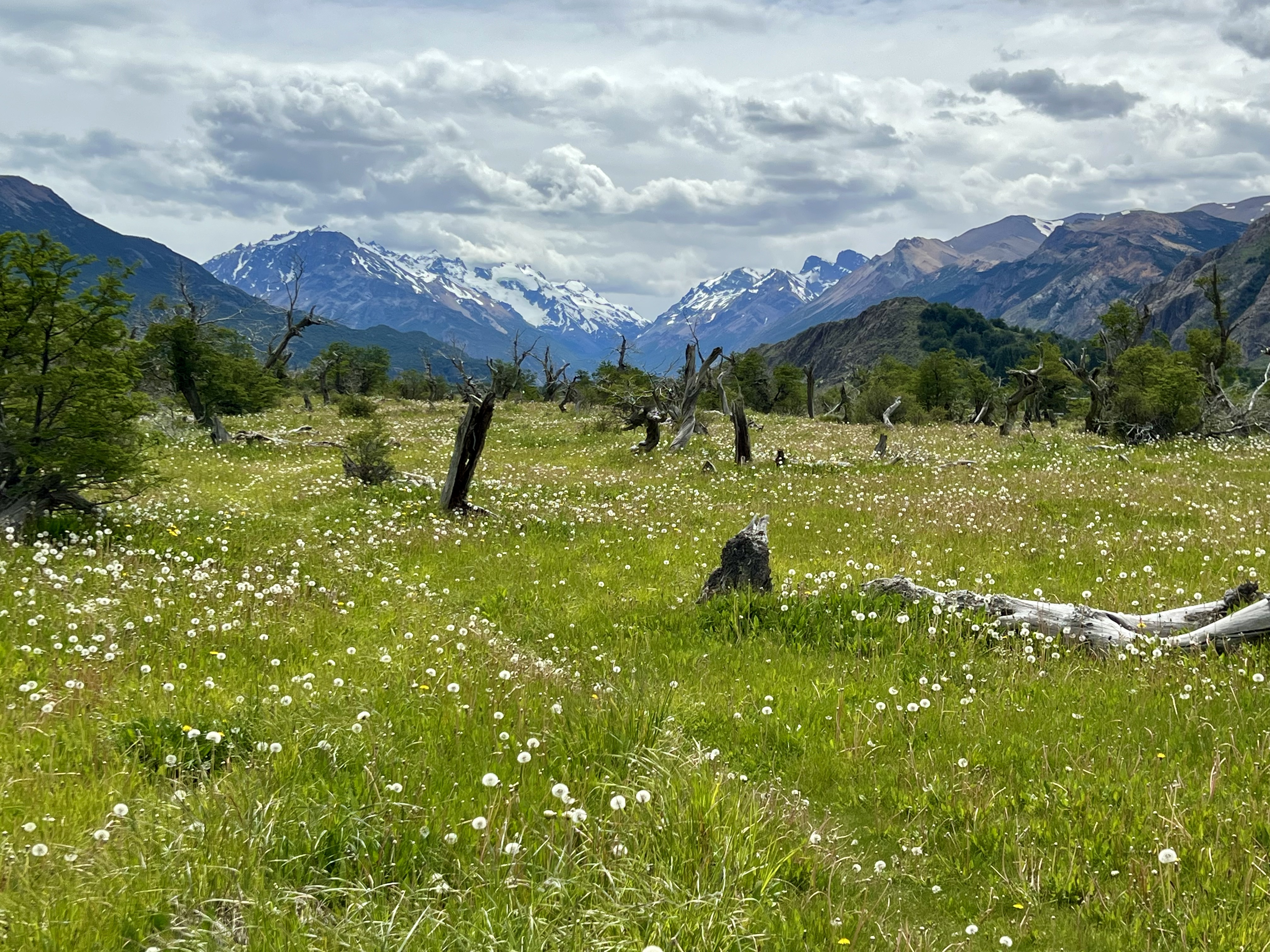
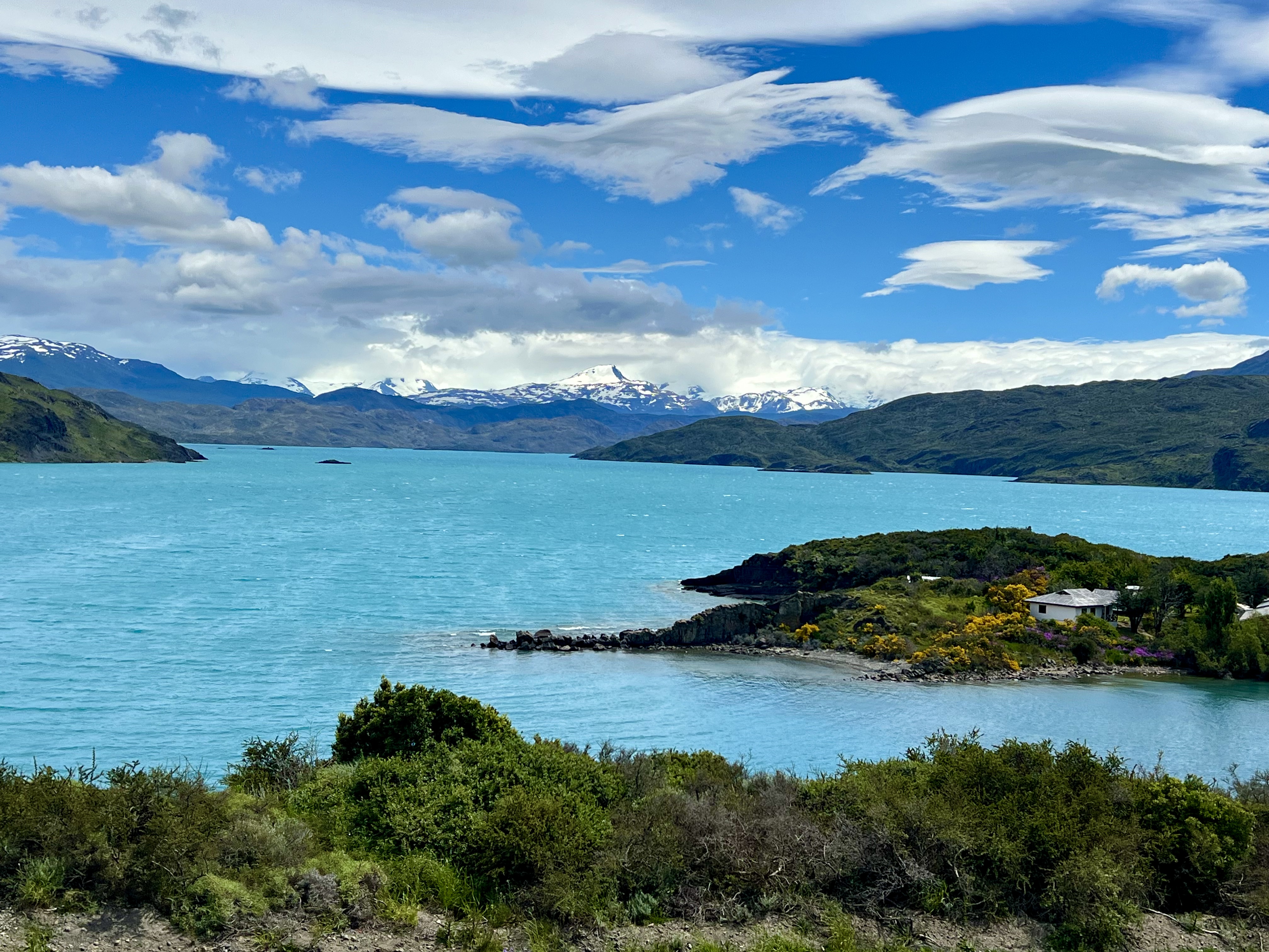
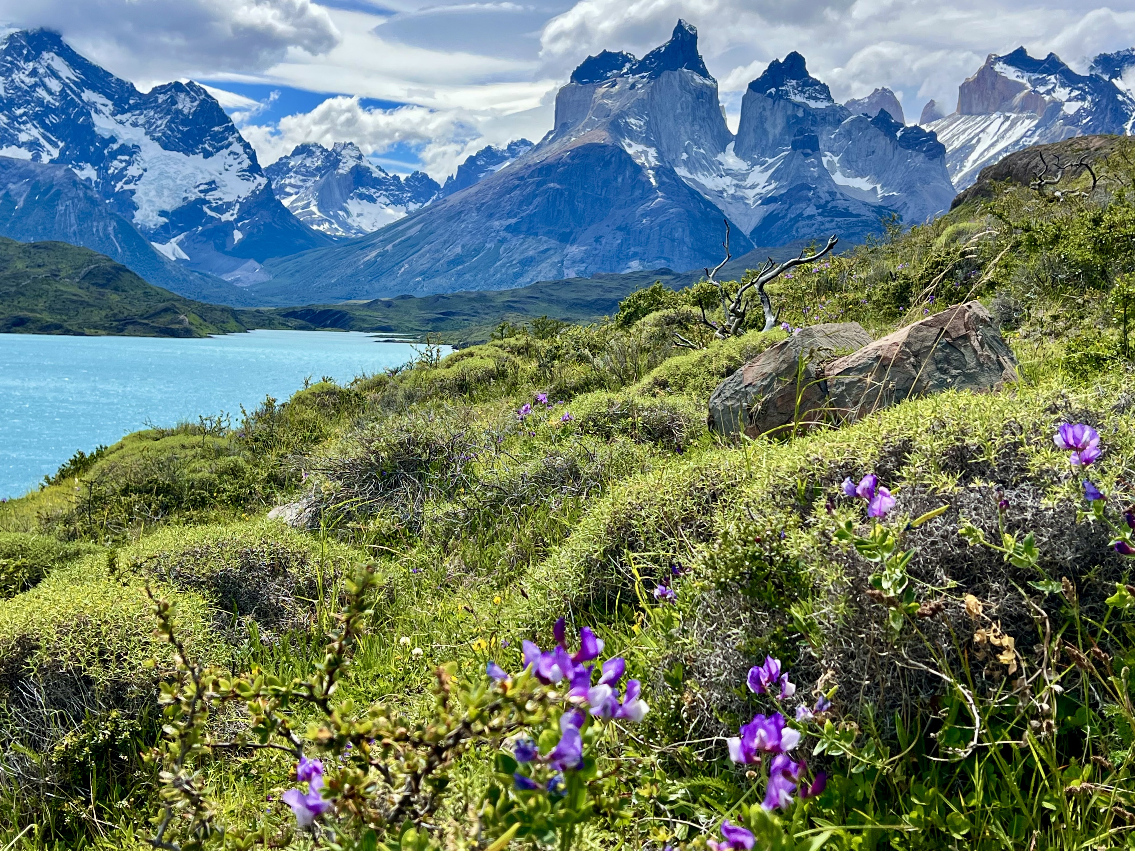
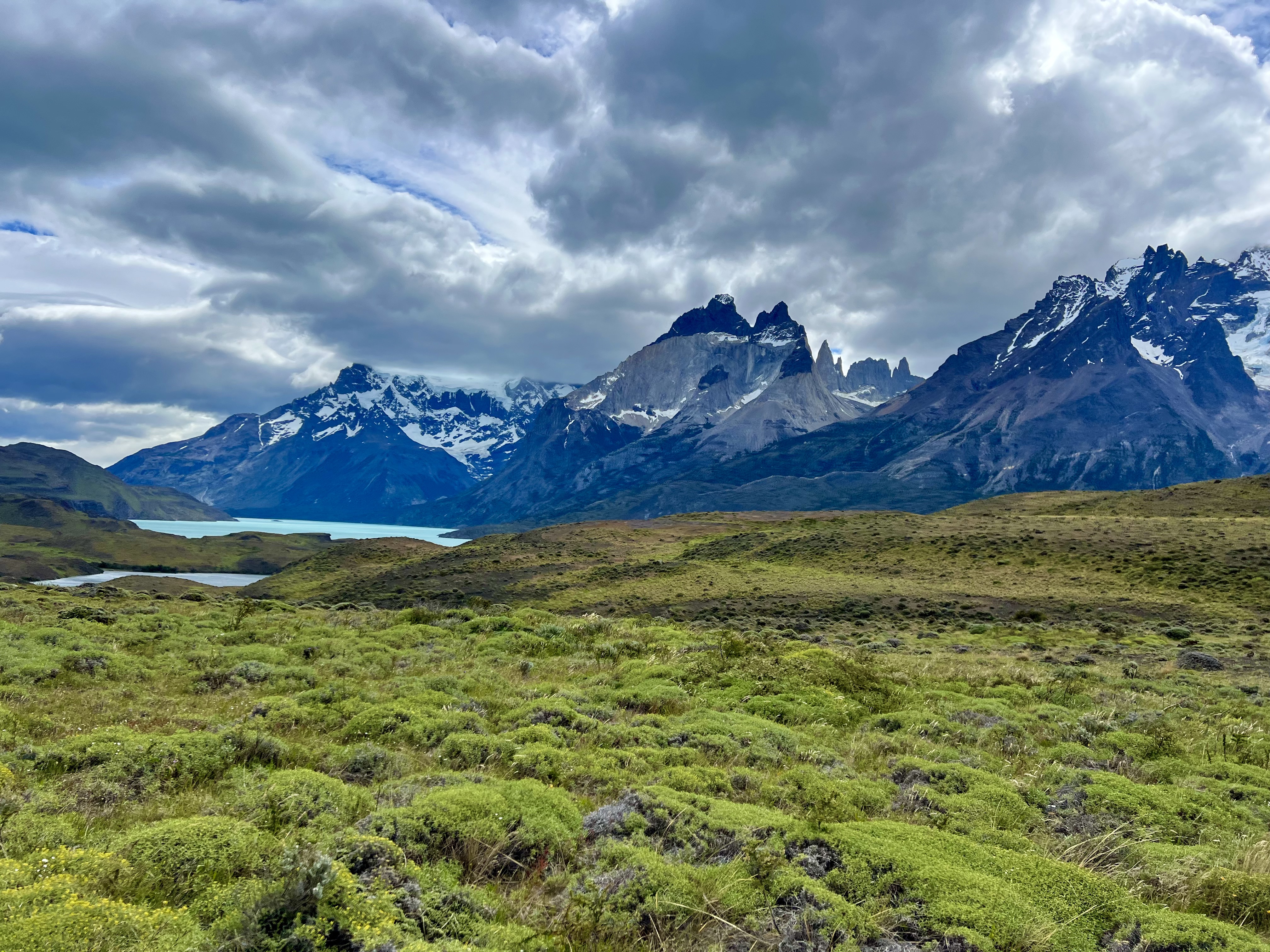
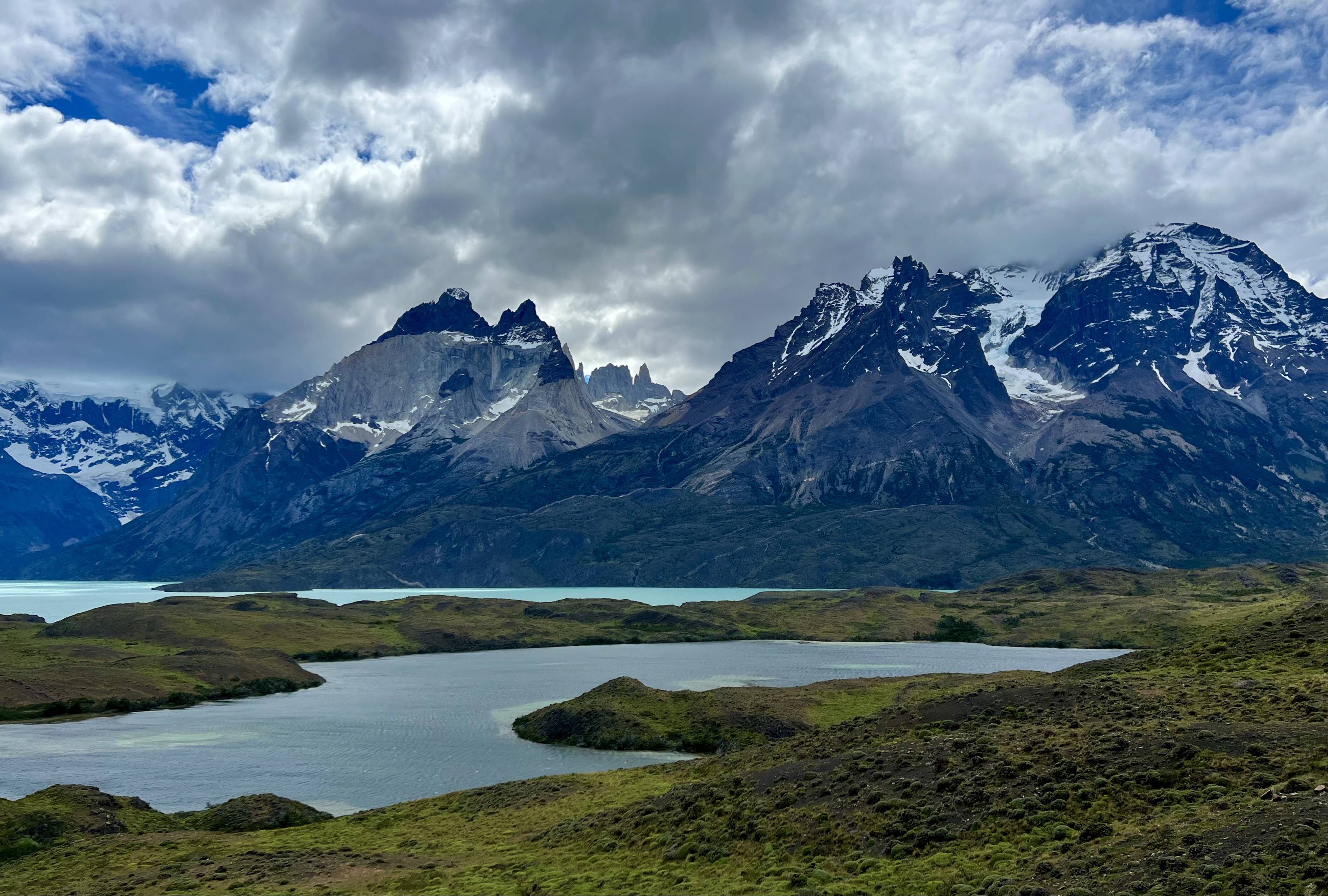
El Calafate is near the southern end of Parque Nacional Los Glaciares, while El Chatlén is at the northern. Lago Viedma is near the northern border, while Lago Argentino, the largest lake in Argentina, borders the south. Adjacent and over the border to the south is the Chilean Parque Nacional Torres del Paine, designated as the 8th natural wonder of the world. This was where I was now headed on a one-day excursion. It would naturally have been better to have spent a few days in the Park, but I didn’t have that much time and still wanted to get there, so the long van ride was the only option. And it was a long van ride with Wilderness Expeditions! It took about three and a half hours to get to the frontera, which has a no-mans’ land between the Argentinian and Chilean sides of the Rio Don Guillermo border crossing. The passport control on both sides went quickly and smoothly, although my seat mate, a woman from Israel, had to forsake the apples and oranges she had brought with her as fruits, vegetables and meats are not permitted to be brought into Chile. From the immigration control, we passed through a much greener pampa than on the Argentinian side. Rain falls more heavily and often on the Pacific leaning Chilean side of the Andes than on the Atlantic leaning Argentinian, which is one of the reasons why many of the Argentinian glaciers are disappearing more rapidly. The region is dotted with lakes and ponds fed by the glaciers. Patagonia is said to have more glaciers than almost anywhere else on earth, although I think if one counts the Himalaya and Karakorum ranges as one, they would have more. Nonetheless, Patagonia is home to an impressive array of white-topped peaks and snow field dotted barren slopes.

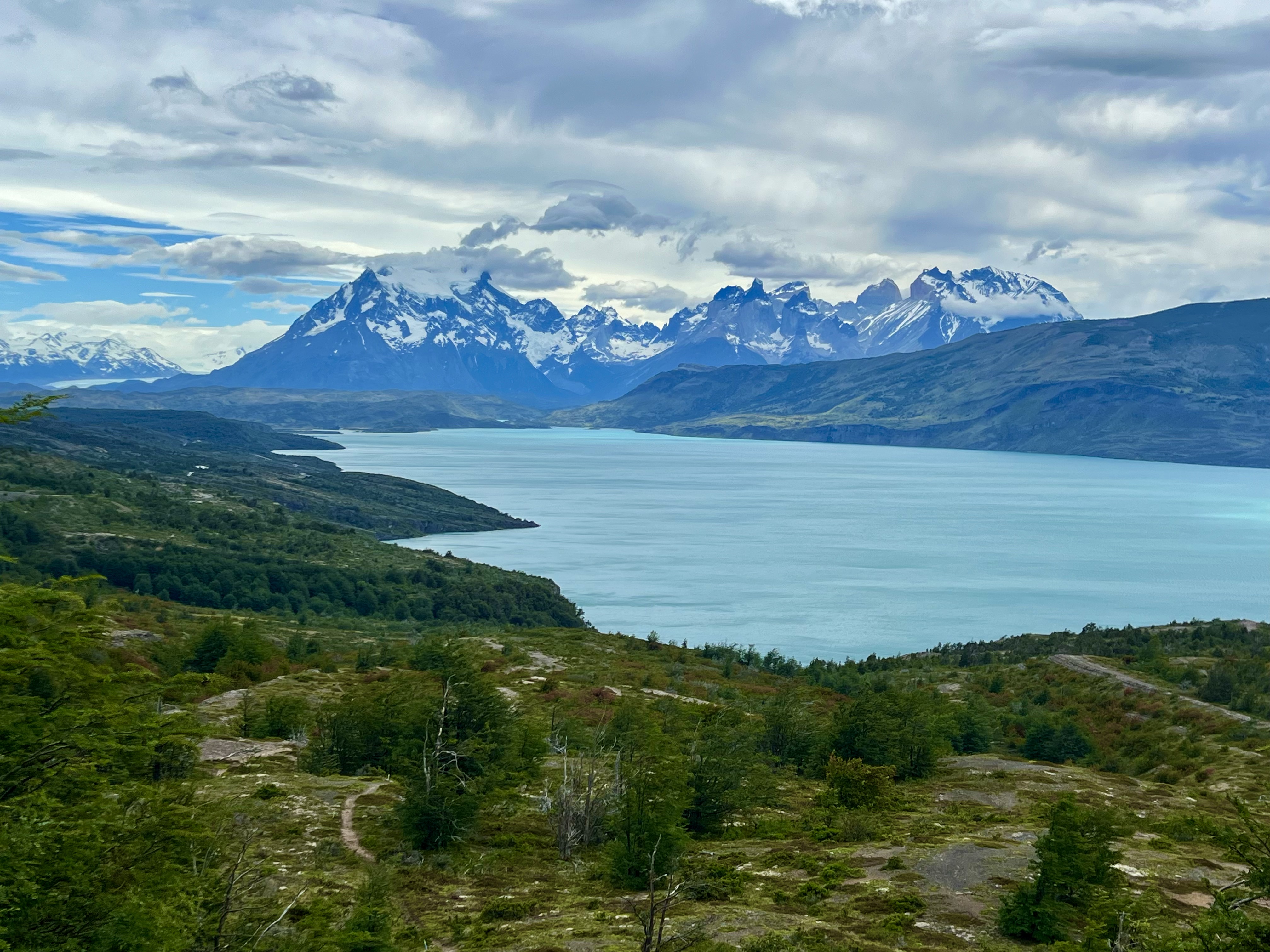
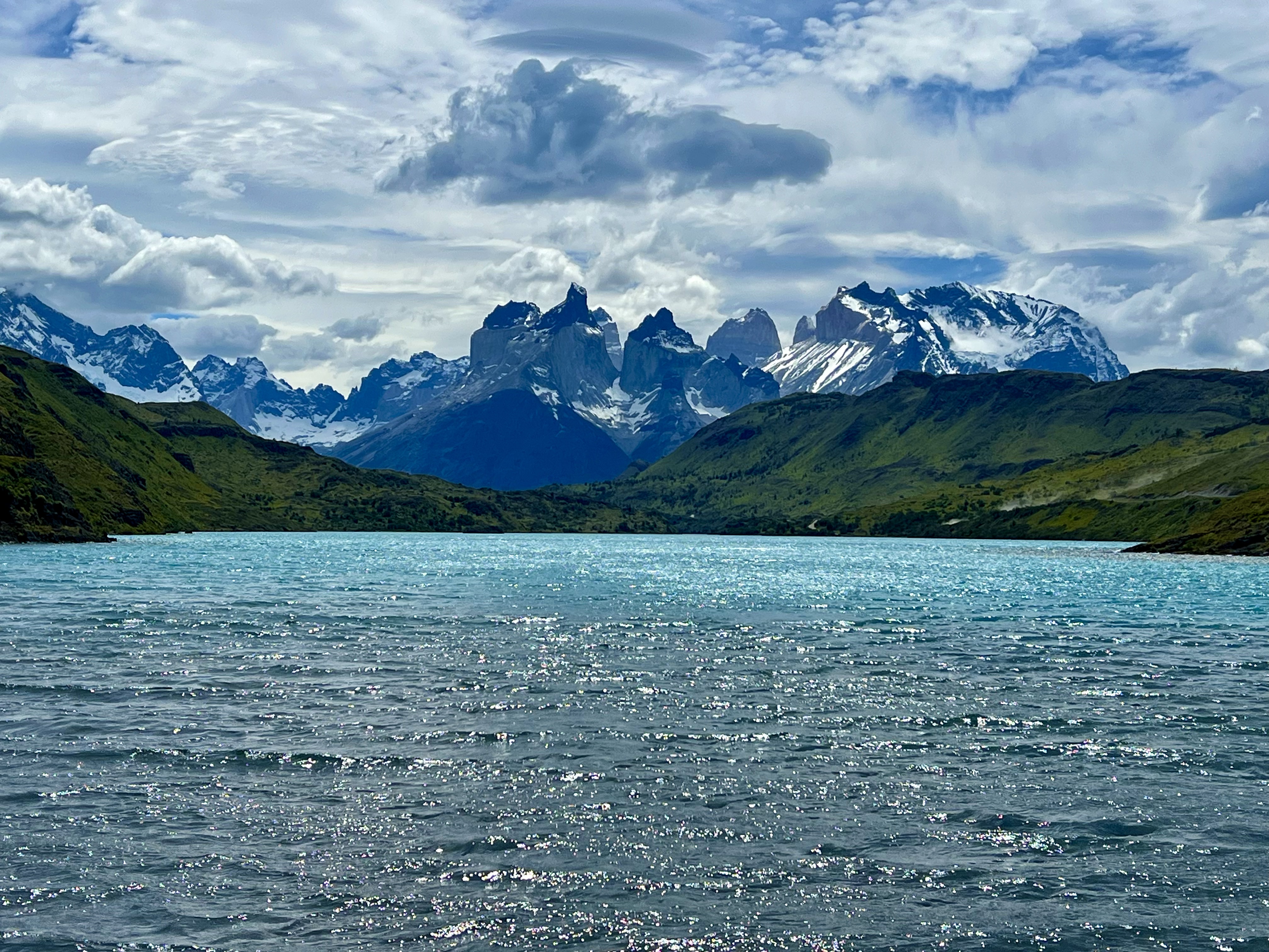
The first lake we passed was Porteño, where we stopped for a quick photo op, then it was on to Lago del Torro and to Lago Pehoé, from where the photo was taken that allowed the park the natural world wonder designation.
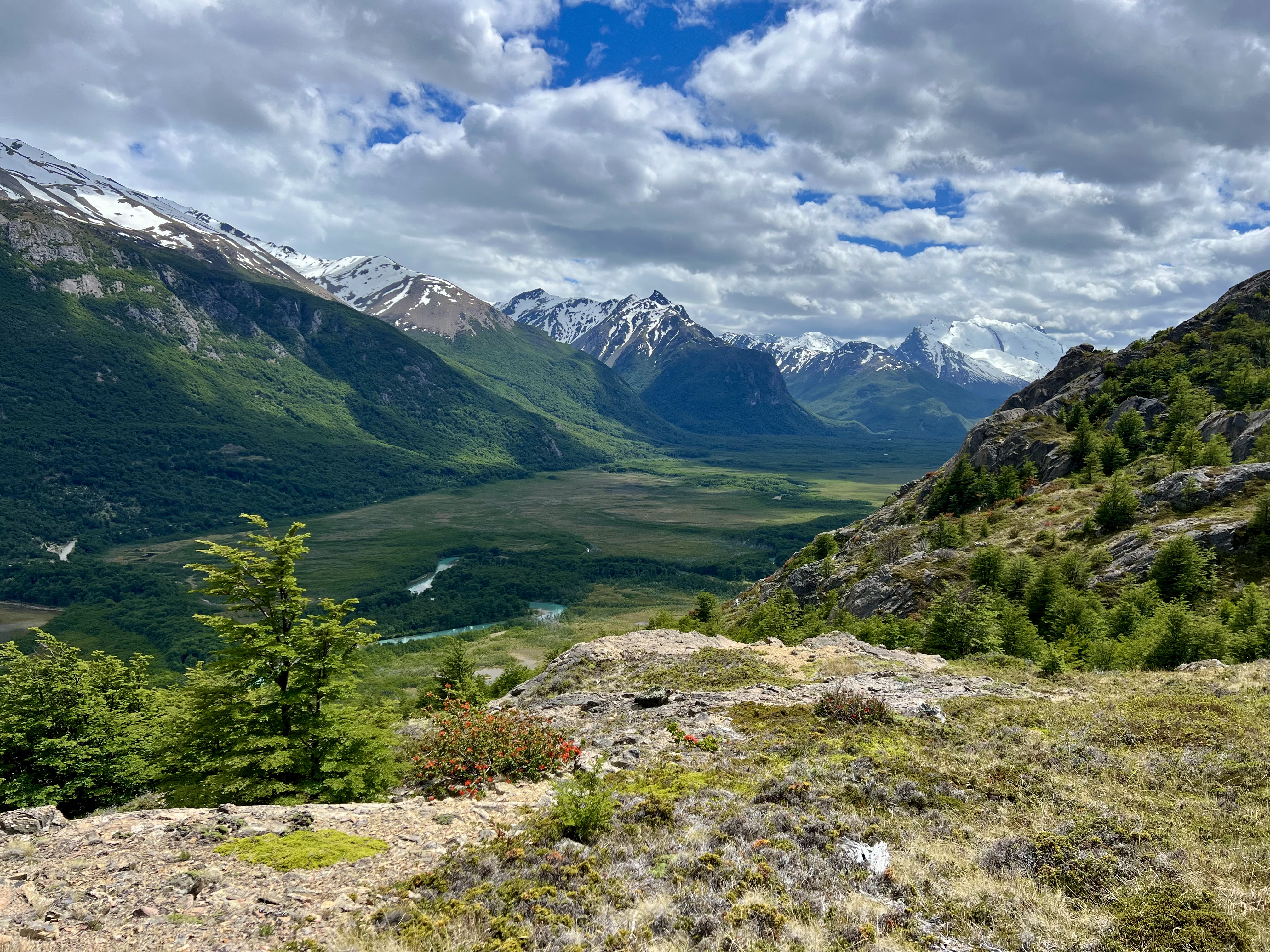
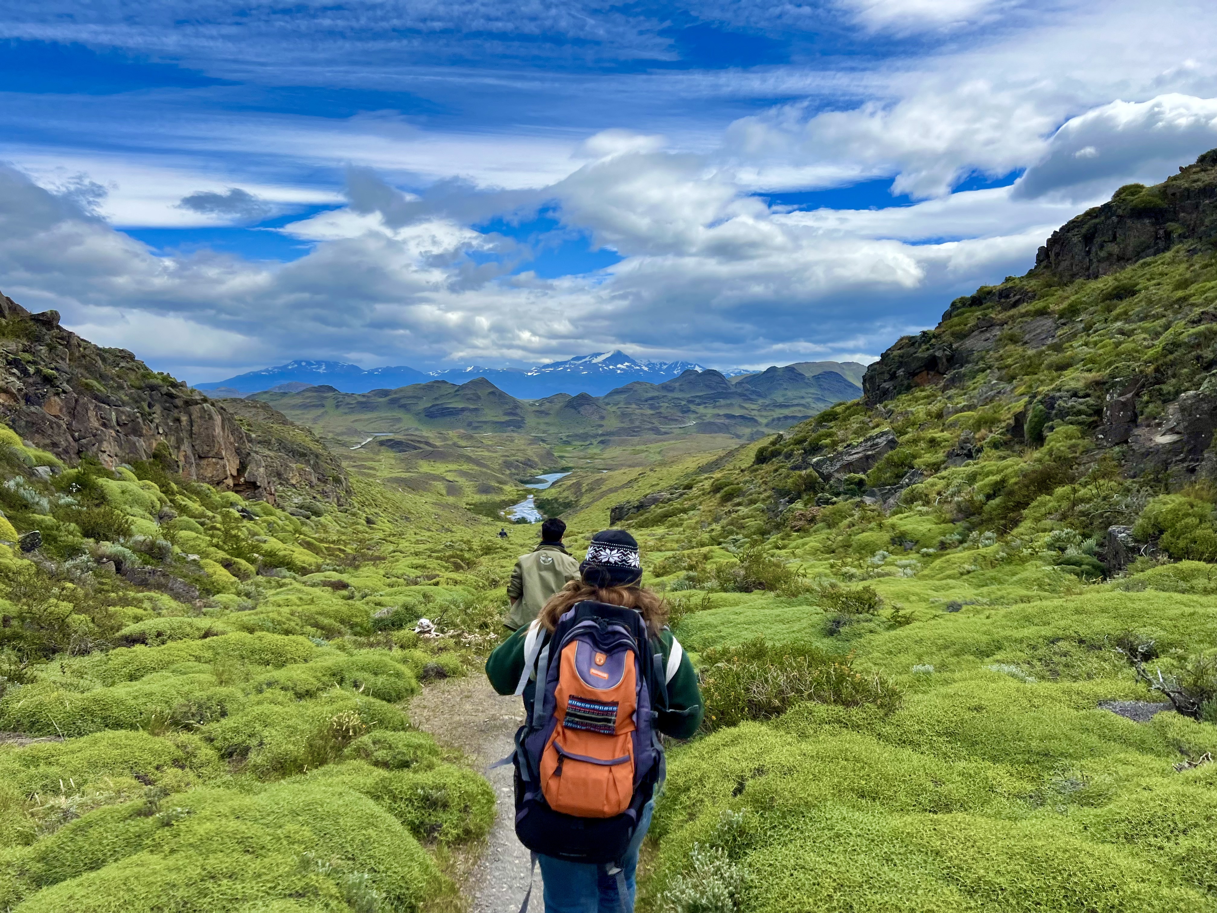
After the various stops for photography, we came to a trail that connected serpentines in the road. The van followed the road, and we got out for about an hour’s walk through the slightly undulating hillsides below Cerro Torres and Cerro Nieto. It was good to stretch the legs and get up closer to the mountains.
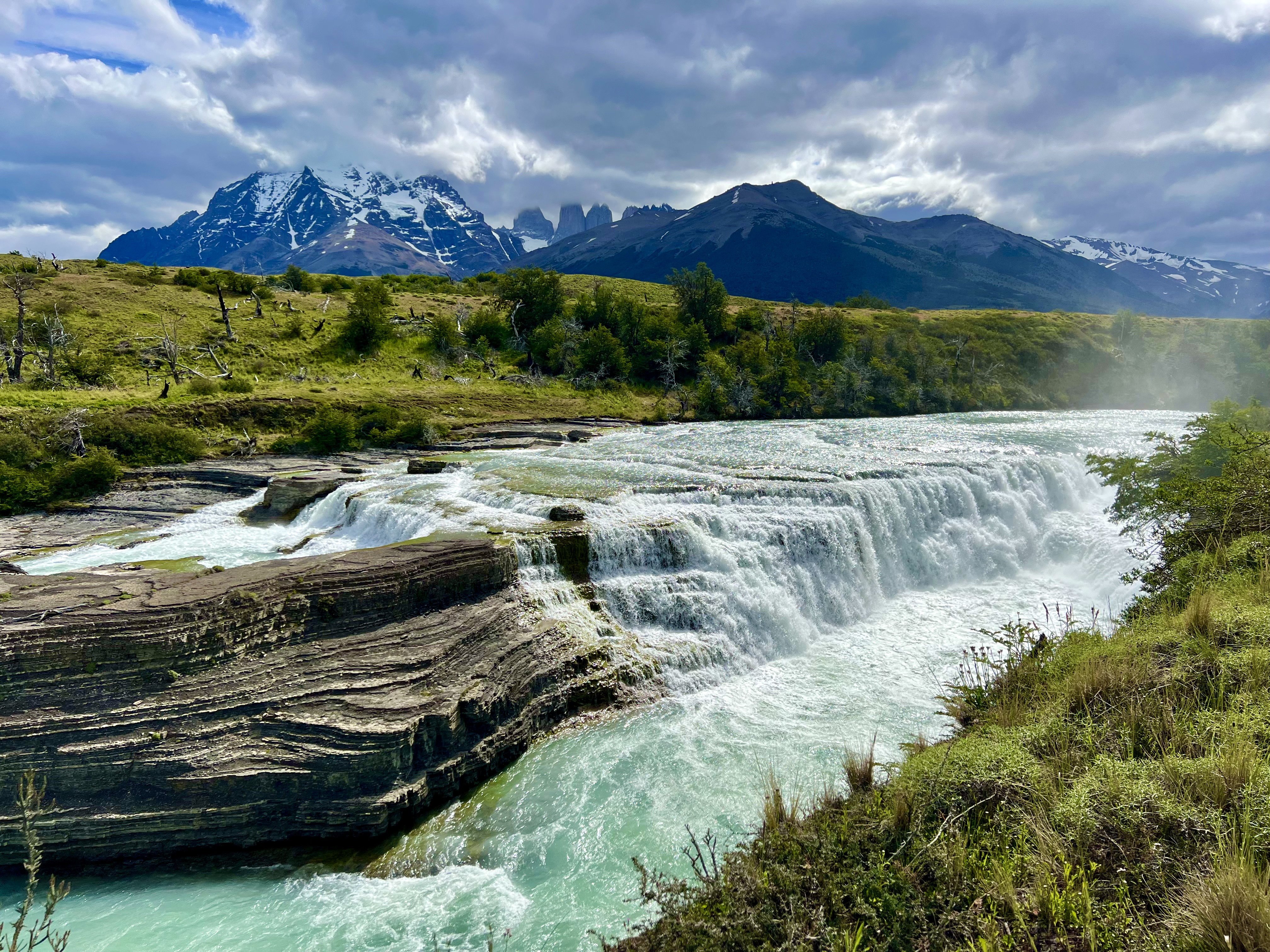
After the walk, the last stop in the Park was at Cascade Paine, a miniature Niagara waterfalls with the Torres as backdrop. The mist from the Falls rose up to greet us and it was perfect. The one-day excursion is long; we left at 6:30am and arrived back at close to 9:30pm, but if one only has one day and this is the only chance to get to Torres del Paine, it is definitely worth doing. The views are simply incredible.

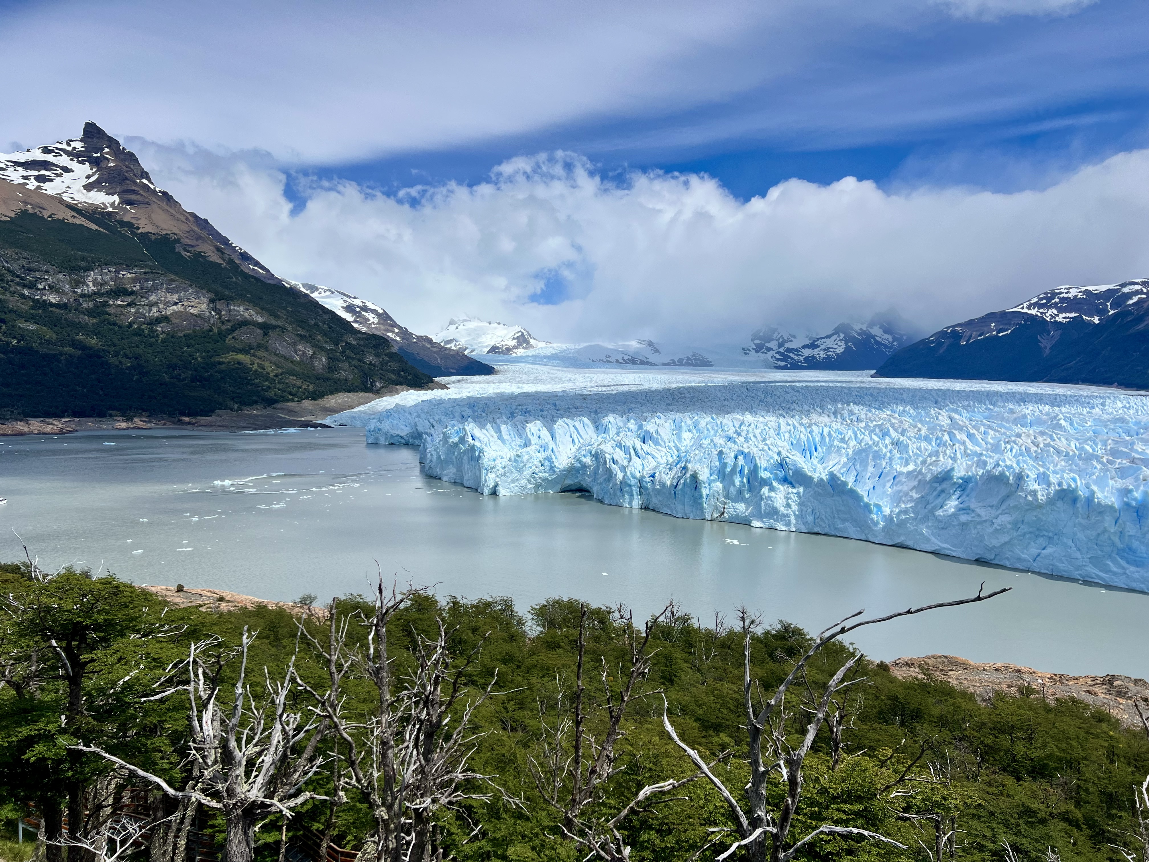
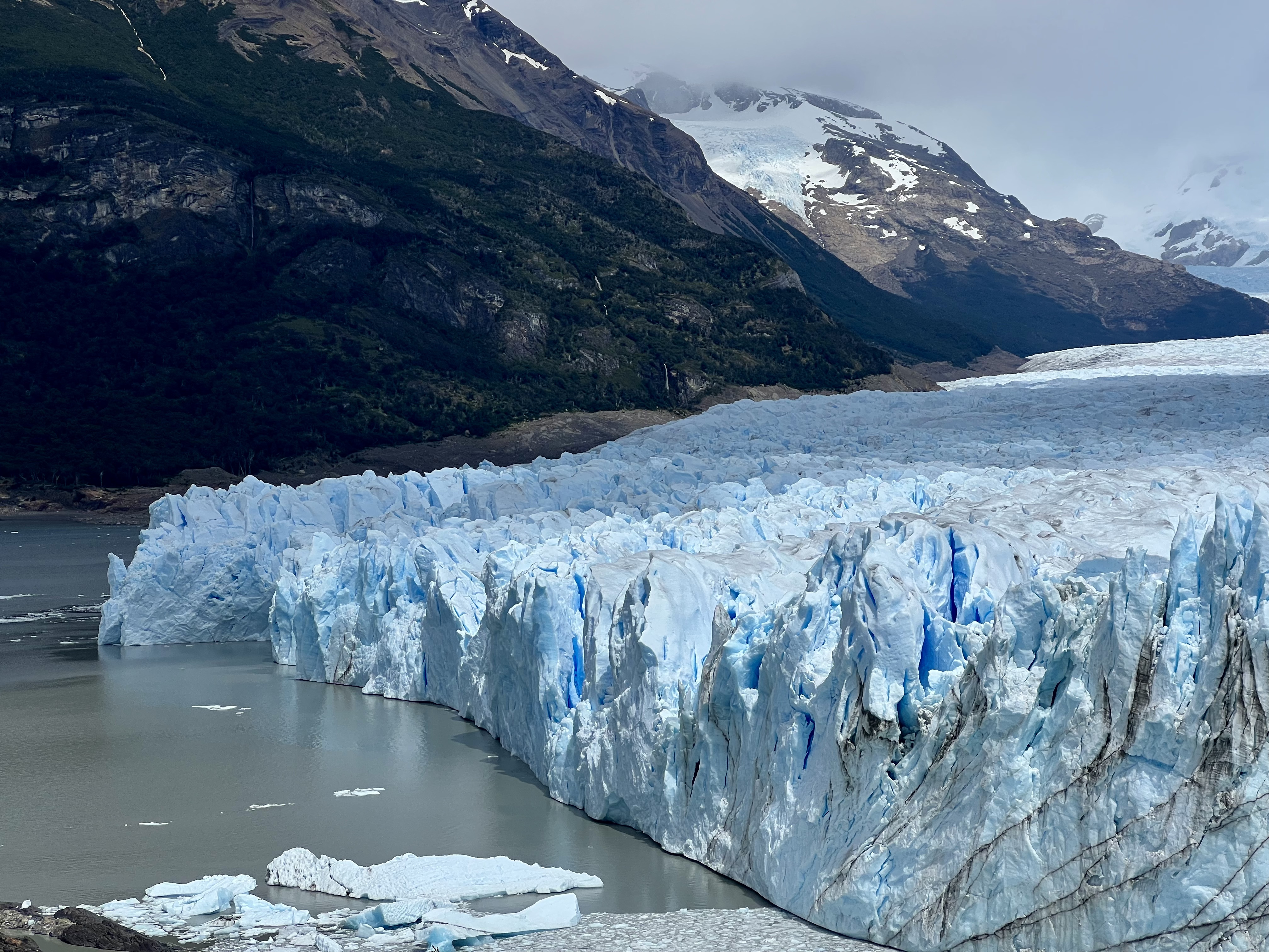
The following day, I took a shuttle bus to the one ‘must-do’ in El Calafate, the Perito Moreno Glacier at the southern end of the Parque Nacional Los Glaciares. I wasn’t sure what to expect as I’ve seen lots of glaciers and didn’t understand why so many of the tour companies were asking astronomical sums for tours to look at a mass of ice, but when I got there, I understood how they could get away with their scalping. This glacier is impressive. It isn’t necessary to go on a tour, though. The paths are metal walkways above the forest floor; there is no way to get lost and there are explanatory signs posted throughout the various senderos.
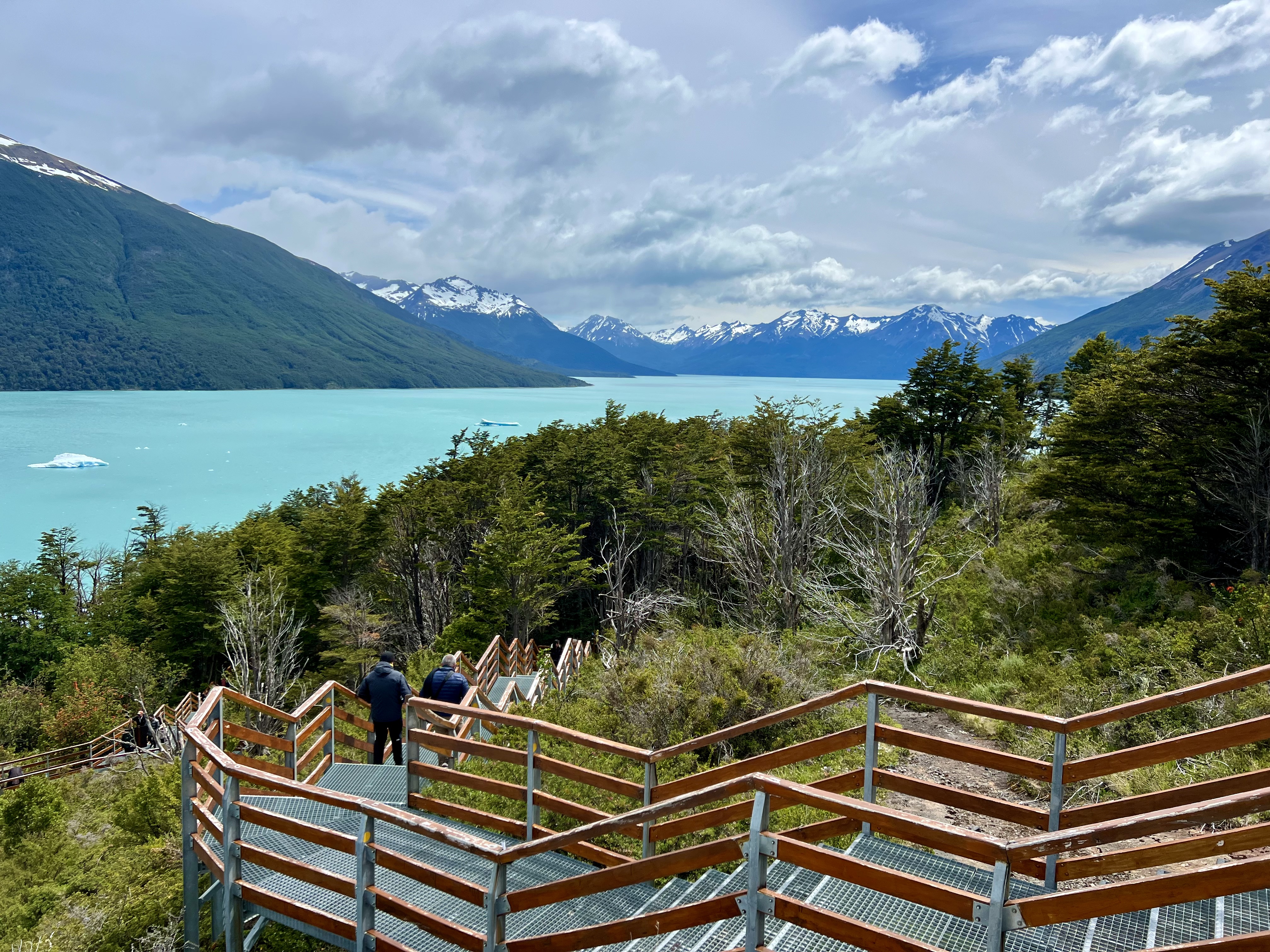
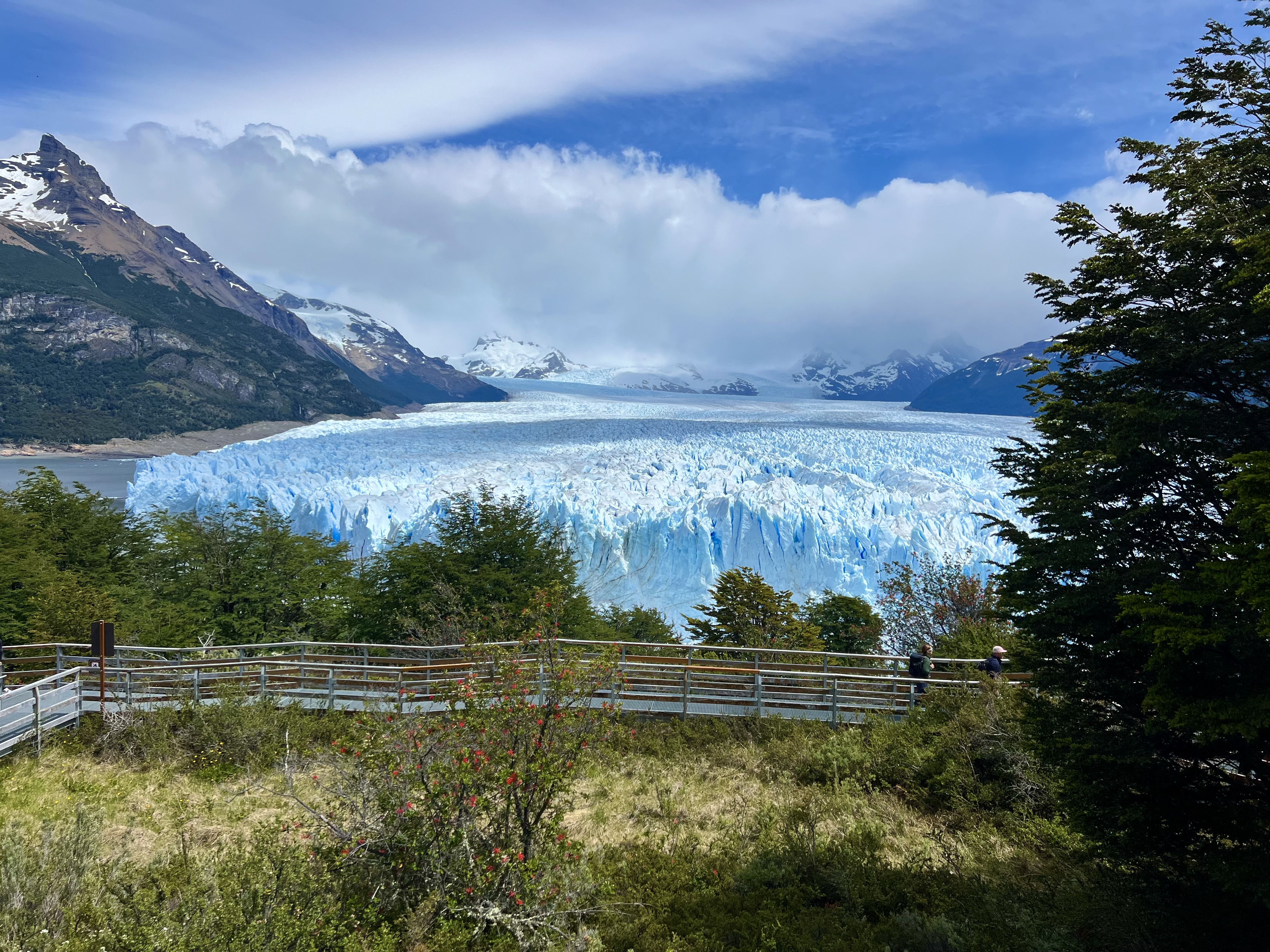
There are four main walks of various lengths, but none more than about an hour and a half and that includes time to stop and wait for the intermittent calving. The Perito Moreno Glacier used to reach the shoreline, but has been retreating, as almost all the others in the Park and worldwide, since 2020. The Glacier is 5km long and covers most of a passageway at the tip of Lago Argentino. According to the signs, the ice is 70m at its highest point, but it looked more like 45 or 50 to me. I don’t know when the signs were posted and how much ice has been lost in the meantime. Regardless, the wall of pinnacled blue ice is dramatic. Calving happens intermittently, but even though I waited to capture one on video, the glacier didn’t give up its offering to the sea until I was in the forest behind trees and couldn’t see it. I could hear it, though, as the crashing comes with a boom. The origin of the Glacier is back in the mountains, where a white cloud had camped out the entire time I was there. Surrounding the Glacier are forests up to about 1,000m, i.e. 400m higher than in Tierra del Fuego, with blackish-grey mountain slopes patched with white snowfields near the peaks. The lake is glacial turquoise green with small icebergs floating near where they calved.

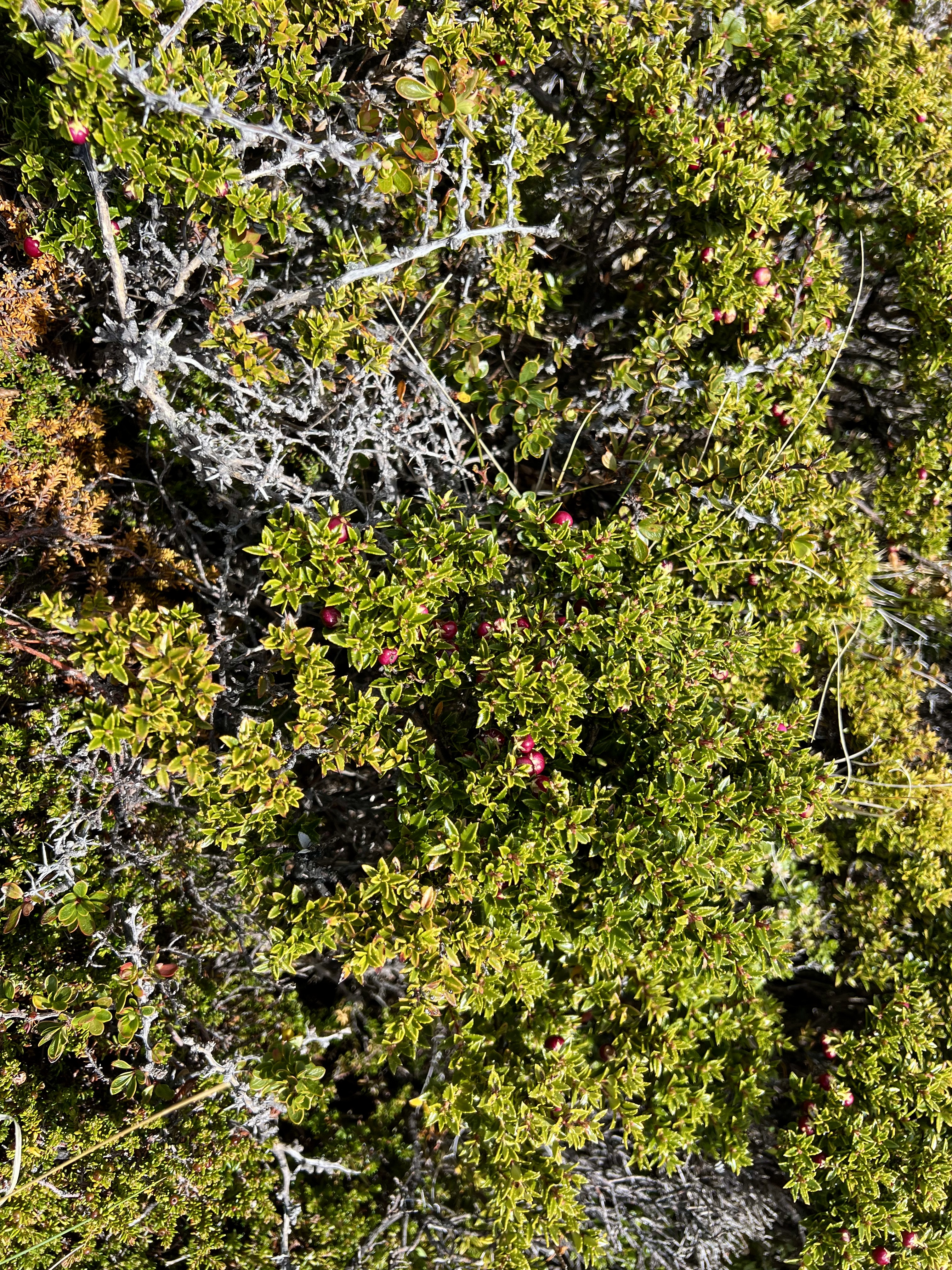
Both national parks, the Parque Nacional los Glaciares in Argentina, the largest in the country and the Parque Nacional Torres del Paine, the smallest in Chilean Patagonia, are stunningly beautiful. Nature here is at its harshest and best. The wind blows ferociously ripping apart all that isn’t firmly and deeply planted in the ground. Water rages or stops entirely. The frozen earth gives way to a few hearty plants that have both medicinal and culinary value. In the spring and summer, the fire flower blooms lighting up the green hillsides. The air pure, the water potable. A harsh land, but a beautiful one. Somewhat like the Tetons in Wyoming, its cousin to the north, or further north the Columbian Icefields near Banff and Jasper national parks in Alberta, Canada, or even further the Mendenhall and Hubbard glaciers in Alaska. The extremes, both south and north, have a unique fragile beauty that begs to be protected from human made damage, including from mass tourism. Here, as elsewhere, one needs to tread softly, look and listen to the forces of nature.